
Read a Little Egg Harbor Street
Parcel records are the practical unit for a Little Egg Harbor address search. Begin with a full address or a road name in the Ocean County tax form. The result can supply a location, municipality, block, lot, qualifier, tax class, values, map reference, and a mailing address when shown. That establishes a parcel, not a household. A taxpayer may be an estate, trust, company, or owner who receives notices elsewhere. Keep each parcel separate while working down a road, especially where a marsh edge, easement, or subdivision line makes the numbered sequence misleading.
- Open the Ocean County Tax List Search, choose Little Egg Harbor, and enter a property location or known block, lot, and qualifier.
- Record the situs address and parcel identifiers, then view the road segment in the Ocean County GIS program.
- Use the parcel identifiers in the clerk index to find the newest deed and read its grantor, grantee, consideration, recording date, and legal description.
- Use the individual voter status form only when the required identity fields are known. A street-arranged list requires an Ocean County Board of Elections request.
- For prior occupants, ask the library staff for a reverse or criss-cross directory and compare the address with the alphabetical entry.
The sequence keeps ownership, registration, and historical occupancy distinct. It also avoids treating a quick web result as a full list of people on the street.
Little Egg Harbor Street Directory Fields
The county tax form is the first address tool, but it is not an owner-name directory. Its visible controls ask for a municipality and accept Property location, Block, Lot, Qual, and Prop class. Select Little Egg Harbor first, then use the street or location text as the starting point. If that is too broad, the tax-map identifiers provide a tighter route. The published form has no visible owner-name field, so a name-only search should not be promised.
| Tax-list field | How it works | Street-directory use |
|---|---|---|
| Municipality | Select Little Egg Harbor | Limits the countywide roll to the township. |
| Property location | Optional street or location text | Useful first pass for an address or road name. |
| Block, Lot, Qual | Optional parcel identifiers | Bridges the tax card to maps and recorded legal data. |
| Prop class | Optional class selector | Can narrow a broad address result. |
| Search | Submits entered criteria | Opens the parcel-level result trail. |
The tax-list form shows the actual address-oriented controls used in this Little Egg Harbor parcel workflow.
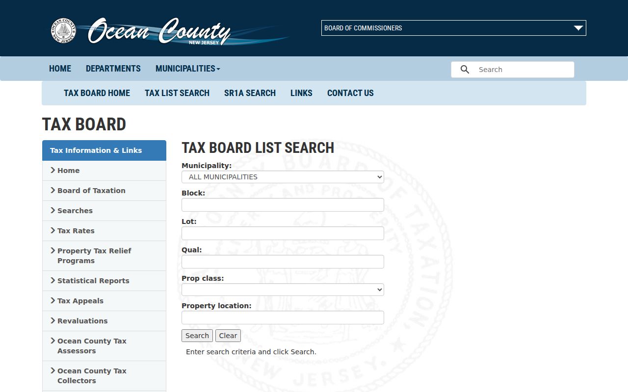
The screenshot shows why a street search becomes a municipality and parcel search rather than a general list of names. Annual assessment data can also lag a later transfer, so confirm key ownership facts in the recorded deed.
Note: The tax collector's account display is informational and can be corrected or reversed, so it is not a substitute for the assessor or clerk record.
Map Little Egg Harbor Street Parcels
County GIS turns an address result into a visual Little Egg Harbor map of parcels. Zoom to a road segment, click or select the parcel polygons, and write down the identifiers before moving to the touching lots. The GIS hub makes parcel and cadastral data available with municipal boundaries, roads and rights-of-way, aerial imagery, zoning, FEMA flood zones, tax maps, wetlands, streams, subdivision plans, and preserved-land layers. These are planning layers, so they help locate and compare parcels but do not replace a tax map or a recorded legal description.
New Jersey's parcel-data page is another way to search geometry by address, county, municipality, block, and lot.
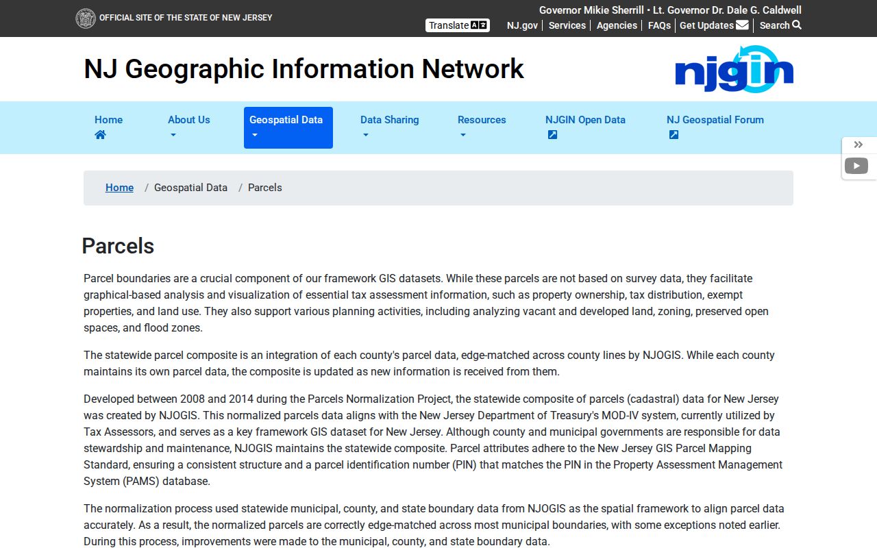
Hosted statewide parcel information redacts owner names under Daniel's Law. Use the geometry and identifiers as a bridge to the appropriate county or township custodian, not as proof that no owner information exists.
Little Egg Harbor Address Labels
Three labels can describe the same Little Egg Harbor property, and they should not be collapsed into one answer. The situs is the physical parcel location shown on a tax map or GIS layer. A tax mailing address is where notices are sent and can be far from the parcel. The legal description is the recorded land identity, often municipality, block, lot, and qualifier, but older deeds may use a tract, subdivision, or metes-and-bounds wording. The deed cover sheet also asks for the grantee mailing address, which is not proof of a residence.
- Parcel
- A defined piece of land identified for tax and map purposes.
- Situs address
- The physical location used to locate the parcel, not necessarily the owner's mailing address.
- Legal description
- The recorded language that identifies land by block and lot, map, tract, or other survey terms.
- Criss-cross directory
- A reverse directory arranged by street and number, used to look for historical occupants or businesses.
These distinctions keep an address-record result honest when one person owns several lots or when an entity, trustee, or estate appears in the title chain.
Trace Little Egg Harbor Street Deeds
Once the address has a block, lot, or legal line, move to the Ocean County Clerk public record search. Search the latest deed by legal data, town and lot/block, or the named party. The deed result can identify grantor and grantee, recording date, consideration, document or instrument number, book and page, legal description, and related documents. To step backward, search the latest seller as a grantee in an earlier transaction. That seller-to-earlier-grantee link is often stronger than a modern house number, which may not appear in an older instrument.
Search spelling variations, entity endings, and old place names. Linked mortgage assignments, releases, and satisfactions can add dates and parties without themselves transferring the property. A map or subdivision reference may also explain why a present lot number differs from the older chain.
Ocean County's BrowseView record index supplies the party, legal, town, date, document, and book/page starting points.
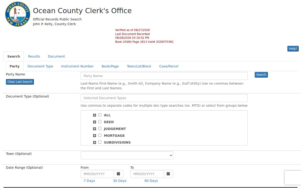
The available tabs make it possible to shift from an address clue to legal data and then to recorded parties. Treat the online image as an unofficial research copy and ask the clerk for an official copy when one is required.
Little Egg Harbor Deed Index Modes
SearchNG has more useful modes than a simple street-name query. Party Name accepts last-name first-name format without a comma and the help page says the system automatically applies a beginning wildcard. A Second Party Name can narrow documents containing both parties, while More Names supports additional names. Legal, town, lot/block, document type, date range, instrument number, and book/page modes let an address-led search follow the parcel even when an address is abbreviated, missing, or replaced by a tract description.
[INSIDER TIP] Start with legal or lot/block data after the tax query, then use More Names and linked documents to sort out entities, spelling variations, and related mortgage records.
The county's SearchNG help page documents the search modes, linked documents, and image controls.
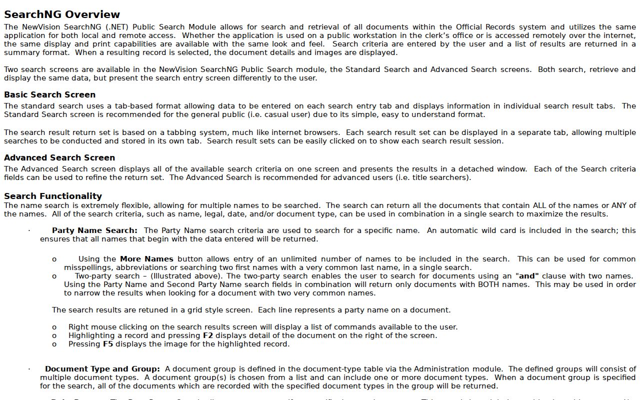
Remote screen copies are marked unofficial and may be watermarked. The portal's result detail and linked-document tools are useful for research, while the clerk remains the source for an official copy or a question about the record.
Older Little Egg Harbor Street Records
The online official-record index begins April 1, 1977. That date is an online access line, not the beginning of an address history. For an older Little Egg Harbor address trail, use the County Clerk counter and deed books, then the New Jersey State Archives county-deed microfilm and the FamilySearch digitized county deed books described by the Archives. The Archives reports microfilm copies of county deeds through 1900, although access to a particular image can still depend on the service or account used.
Jurisdiction labels also matter. Little Egg Harbor was established in 1740, appears in Burlington County material, became part of Ocean County after the county's 1850 creation and its 1891 local transition, and lost land to Tuckerton's 1901 incorporation. An old address under another county or town label does not alone prove that a household moved.
Note: Preserve the date and legal description with each older hit because a historical township or county label can be the key to the next book or microfilm search.
Little Egg Harbor Street Record Sources
Address-keyed sources answer different questions. The assessment roll identifies a parcel snapshot; GIS supplies its relationship to the road and nearby lots; a deed records a land transaction; a voter list documents registration at a point in time. None is a universal household roster. Using the sources in sequence produces a more reliable Little Egg Harbor street-record result than treating one name, map, or mailing address as conclusive.
| Address source | Custodian | What it can establish | Access route |
|---|---|---|---|
| Tax list and maps | LEHT Assessor / Ocean County | Location, block, lot, class, value, and tax-map context | Online form or assessor contact |
| Parcel GIS | Ocean County GIS | Parcel geometry, road context, zoning, flood, wetlands, and ROW | Public map hub |
| Recorded deeds | Ocean County Clerk | Parties, transfer dates, consideration, legal data, and linked documents | Online from 1977, counter and records route for older work |
| Voter lists | Ocean County Board of Elections | Statutory voter-list information, subject to protections | Signed OPRA and Election Order request |
| Permits and certificates | LEHT Construction Department | Address-related application, inspection, and alteration evidence | Targeted open-permit request or OPRA |
The Little Egg Harbor Tax Assessor is the local contact for tax-map interpretation and corrections. Mandi Johnson, CTA, is listed at 665 Radio Road, (609) 296-7241 ext. 247, and assessor@leht.com. The posted tax maps are dated October 1, 2023, with an instruction to call for updates.
Little Egg Harbor Address Permits
Permits, certificates of occupancy, and code files can date changes along a street. Little Egg Harbor publishes an Open Permit Request Form and construction, zoning, and code-enforcement forms, but the research found no public permit-by-address search portal. Send a focused request with the known address, permit type, and date range, or make an OPRA request for existing records. The Construction Department can also be reached at (609) 294-9071.
A permit may name an owner, contractor, agent, or designer. It can help explain when a structure was built, raised, altered, bulkheaded, or converted, but it does not prove who occupied the home. That limit is especially important when a Little Egg Harbor by-address search concerns a waterfront parcel or a property held by an entity.
Little Egg Harbor Coastal Street Layers
Some Little Egg Harbor addresses look simple in a postal list but complex on the ground. The county's flood, wetlands, streams, zoning, easement, right-of-way, aerial, tax-map, and subdivision/site-plan layers help explain an irregular waterfront boundary, a narrow access corridor, or a lot whose legal line reaches beyond the visible road frontage. The county also identifies a 2025 Parcel & ModIV geodatabase as its local data reference.
Use those layers to understand the land, then return to the block, lot, and legal description for the title search. Statewide parcel geometry is useful, but New Jersey warns that it is not a tax map.
Little Egg Harbor Reverse Directories
For a past reverse-directory entry, the documented local route is the Ocean County Library Wheeler Room, which holds old city directories and phonebooks, yearbooks, maps, and atlases. Ask staff for a reverse or criss-cross volume and for place variants such as Tuckerton, Ocean County, Mystic Islands, and West Creek. The exact Little Egg Harbor runs, publishers, abbreviation keys, and street renumbering history were not verified online, so they should be checked in the volume rather than guessed.
The Little Egg Harbor city directories collection has the fuller historical-shelf route. A reverse entry can suggest a past occupant or business at an address, but the alphabetical page, issue date, and a deed or census record are useful checks before drawing a family-history conclusion.
Limits of Little Egg Harbor Street Results
A Little Egg Harbor street-level search cannot reliably identify every person at an address. Household members without an ownership or registration record may not appear in property material. Utility and delivery-customer lists are not public street tools, motor-vehicle addresses are restricted, and private membership rosters are outside this record chain. A no-hit can also reflect an LLC, trust, estate, old tract name, spelling variation, protected address, or sealed record rather than an empty property.
[MYTH] A public parcel or voter record does not reveal every occupant. The Address Confidentiality Program and Daniel's Law information office explain why a legitimate address may be substituted or redacted.