
Little Egg Harbor Township Neighbors by Block
The block, not a long street chain, is the useful unit for finding Little Egg Harbor neighbors. Start by identifying the parcel that contains the address, then examine only the touching parcels. Parcel geometry, tax details, deed parties, permits, voter material, and local-history resources answer different questions. They must not be merged into a single household roster. An owner may be an entity, a trustee, an estate, or an agent, and a nearby resident may have no visible ownership record.
| Source | What it shows about a block | Access |
|---|---|---|
| Ocean County GIS | Parcel geometry, roads, boundaries, cadastral context, and map layers | Public planning map and data hub |
| Ocean County tax list | Municipality, block, lot, qualifier, class, location, values, and related parcel fields | Public search by location or parcel identifiers |
| Ocean County Clerk deeds | Transfer parties, legal description, recording dates, consideration, and linked documents | Online index from April 1, 1977; counter and archival alternatives |
| Township permits | Address-linked construction, certificate, or site-plan evidence where releasable | Targeted request or OPRA; no public result interface located |
| Voter records | One-person status or lawful statutory-list fields | State identity form; county OPRA and Election Order route for fuller list |
| Library and Chamber resources | Historical community context and participating public businesses | Ocean County Library collections and public Chamber directory |
The table separates evidence from conclusions. A tax or deed record can identify a parcel party, while the voter file is a registration record. The map locates land. None of those sources proves that every person in a nearby household is present today. Use a second independent record before treating a connection as reliable.
Note: For a whole named street rather than a single block, use the Little Egg Harbor by-street directory workflow.
Map a Little Egg Harbor Township Block
The Ocean County GIS map hub is the geographic starting point. Zoom to the address, use the parcel or cadastral layer, and click the parcel polygon. Record the municipality, block, lot, qualifier, and any legal-description clue shown by the authoritative parcel source. Then move only to polygons that touch the starting parcel. A coastal or irregular tract may meet another parcel at a narrow boundary, access strip, right-of-way, wetland edge, or water feature, so the visual map must be read with its layers.
Use this simple sequence: address → starting parcel → touching parcel polygons → municipality/block/lot/qualifier → tax detail → deed search → compare separate records. Keep one row of notes per parcel. Do not combine adjacent lots just because they share a street name, a mailing destination, an organization, or a similar owner name. That keeps a neighbor search tied to the physical block around the address.
The New Jersey parcel-data page describes address, county, municipality, block, and lot access through Property Explorer.
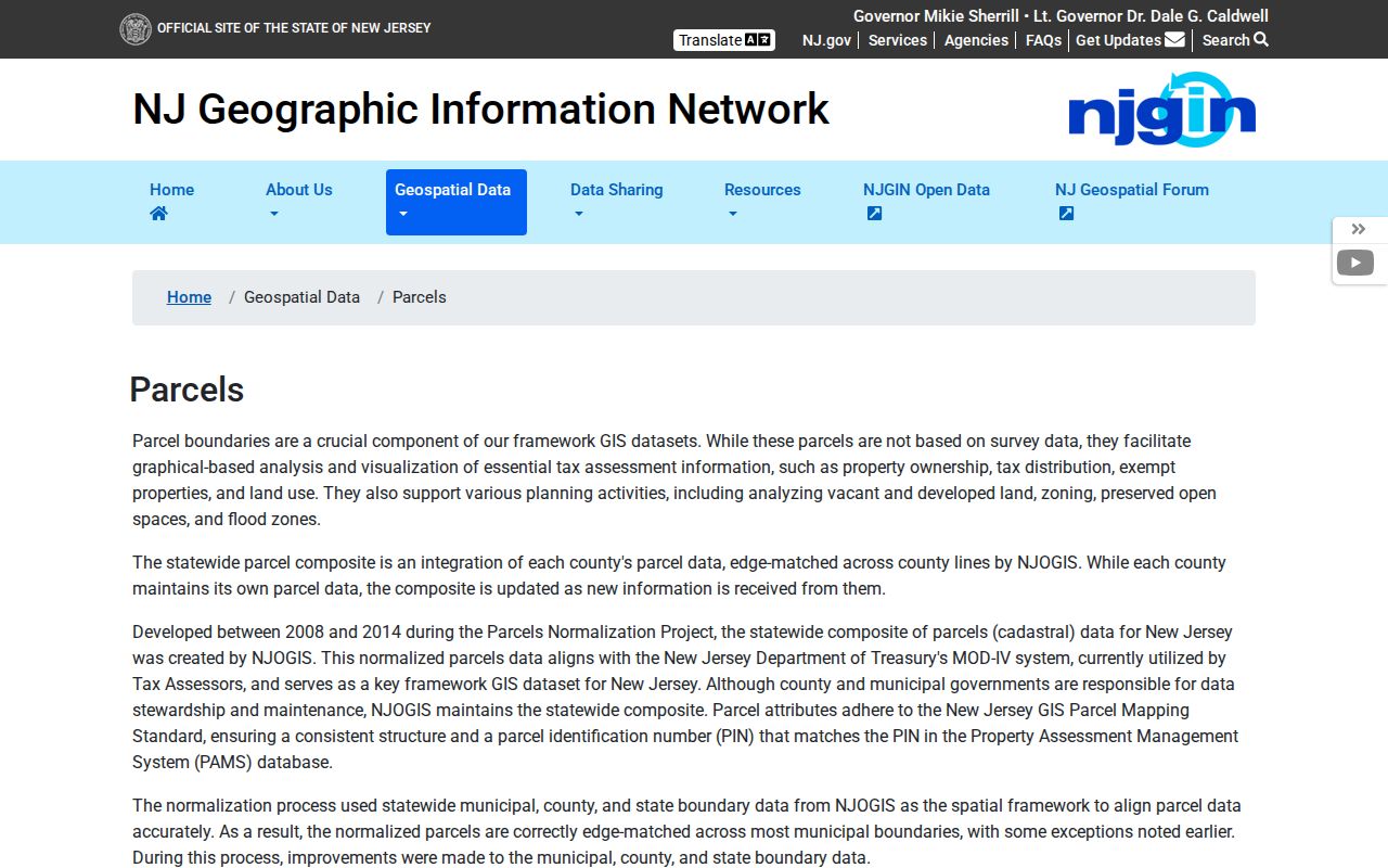
NJGIN is useful for parcel geometry and identifiers, but it warns that owner names are redacted from hosted parcel and tax-list products under Daniel’s Law.
Little Egg Harbor Township Neighbor Parcel Terms
Ocean County’s parcel language lets a block search stay precise when an address is incomplete or a waterfront tract has an unusual outline. The normal identifier is municipality plus block, lot, and qualifier. A deed may instead use a subdivision reference or a tract and metes-and-bounds description. Capture the exact parcel reference before opening another source. A physical street address, tax mailing destination, and recorded legal description can point to different things.
- Situs address
- The physical location of the parcel shown on a tax map or assessor record.
- Block and lot
- The municipal tax-map identifiers used to distinguish one parcel from another.
- Qualifier
- An added unit or parcel identifier when a block and lot alone do not fully identify the property.
- Legal description
- The recorded language that identifies land by block and lot, subdivision, or older boundary measurements.
A mailing address can belong to a tax agent, trustee, owner, or organization and is not proof of residency. The same caution applies when one entity owns several nearby parcels. The block record should retain the parcel’s own identifiers so a later deed or permit request can be tied to the right lot.
Little Egg Harbor Township Tax List Details
The Ocean County Tax List Search uses Municipality, Block, Lot, Qual, Prop class, and Property location. Choose Little Egg Harbor first, then search the location or use the parcel identifiers copied from the map. The visible form does not expose an owner-name field. A public detail card can show mailing address and city/state, location, class, land and improvement values, descriptions, zone, map, deed date, book/page, sale history, and assessment history. The research sample did not show an owner name.
That result is a parcel and assessment record, not a roster of Little Egg Harbor neighbors. It may update on an annual or administrative schedule. Transfers can lag the annual file. When an ownership question remains, compare the legal description with the Ocean County Clerk’s official-record index or ask the municipal assessor for correction and interpretation through the Little Egg Harbor Tax Assessor.
The Ocean County tax-list form shows the exact fields used to move from a Little Egg Harbor address to a parcel record.
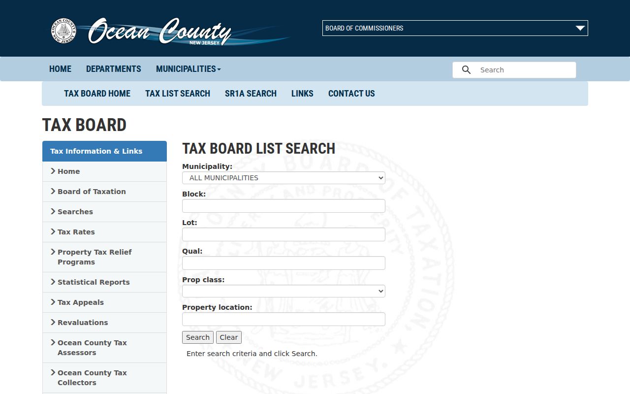
The form’s block, lot, qualifier, class, and property-location controls help keep neighboring parcels distinct.
Note: The tax-list search has no visible owner-name input and should not be described as an owner-name directory.
Little Egg Harbor Township Neighbor Voter Access
The public New Jersey Voter Search checks one person at a time. It requires first name, last name, and date of birth in MM/YYYY format, with an optional middle initial. It cannot browse a Little Egg Harbor block by name alone. N.J.S.A. 19:31-18 authorizes voter lists with name, address, date of birth, political affiliation, and voting history, subject to statutory exceptions and redactions. Voting history means participation, not ballot choices.
A fuller Ocean County voter list follows a separate path. The Board of Elections information-request page requires a completed, signed OPRA form sent by mail or fax. A comprehensive list also needs an Election Order form with the requested format and processing preferences. The Board states that requests are normally processed in seven to ten working days, although election periods can affect timing. State the municipality, election districts, fields, and date range needed rather than attempting to extract a list from the one-person status screen.
Little Egg Harbor Township Neighbor Map Limits
A common mistake is to treat a public map or property record as a full list of neighbors. It is not. County GIS geometry is broadly public, while hosted owner names can be redacted under Daniel’s Law. The state parcel material is a planning representation, not a tax map. The map may show a parcel boundary, flood layer, easement, road right-of-way, or wetland edge without resolving the identity of a resident or the current use of a building.
| Official record trail | Private compiled neighbor category |
|---|---|
| Shows source, date, custodian, and limits for a parcel, deed, voter request, or permit record. | May merge old addresses, marketing data, and same-name results without clear provenance. |
| Lets a reader check the original custodian when information conflicts. | Can be stale, incomplete, or unable to account for protected records. |
| Uses parcel identifiers to keep adjacent lots separate. | May group people by a broad street or radius without showing the underlying record. |
Myth: A public property or voter record does not list every occupant of a Little Egg Harbor household. Household members, protected voters, and people absent from ownership records may not appear. Use the original office’s record for its stated purpose, not as a complete neighborhood roll.
Little Egg Harbor Township Neighbor Community Context
Community resources can add history without creating a private household directory. The Ocean County Library’s Tuckerton Branch provides local research access, while the Wheeler Room at the library’s headquarters holds old directories, phonebooks, yearbooks, maps, atlases, pamphlets, and magazines. The Tuckerton Beacon archive covers 1917 through 1987, with complete access in branches or library Wi-Fi and remote access for 1917 through 1922. Its notices can place a name in a school, civic, business, or family context at a particular time.
| Community resource | What it can contribute | Boundary |
|---|---|---|
| Ocean County Library, Tuckerton Branch | Research help and library access to local and historical resources | Not a current household roster |
| Wheeler Room collections | Old directories, phonebooks, yearbooks, maps, and historical reference material | Exact Little Egg Harbor directory runs require volume inspection |
| Tuckerton Beacon archive | Obituaries, civic notices, school items, businesses, and local events | Historical context, not current residency proof |
| Little Egg Harbor Chamber directory | Participating public businesses and community activity | Not a private association or household membership list |
No official umbrella directory of township neighborhood associations was located. Do not invent an association name or infer membership from a street. The public Chamber directory and library collections are documented resources, while private memberships and household rosters remain outside this record trail.
Little Egg Harbor Township Coastal Neighbor Layers
On a coastal block, adjacency can be less obvious than two homes facing the same road. Ocean County GIS supplies parcel and cadastral layers alongside aerial imagery, zoning, FEMA flood information, tax maps, wetlands, streams, easements, rights-of-way, parks, preserved land, subdivision plans, and site plans. The county’s 2025 Parcel and ModIV geodatabase is the dated parcel-data reference. These layers help explain why a nearby parcel is narrow, separated by water, or reached through an access corridor.
They do not decide ownership or residency. Use them to understand the shape of a block, then bridge the recorded municipality, block, lot, and qualifier into the tax record and deed index. If a map appears to conflict with a tax map, contact the assessor or county GIS program rather than treating the planning image as the final legal answer.
Note: Flood, wetland, easement, and right-of-way layers explain physical context but do not identify a person or authorize access across private land.
Monitor Little Egg Harbor Township Parcel Changes
Ocean County’s free Property Alert is a forward-looking tool for a parcel already identified in a block search. It can match a party name or municipality, block, and lot and sends an email after account verification when a matching recorded document appears. Multiple people can subscribe for one property or name. The alert applies to Ocean County land whether occupied or vacant.
It detects a matching recorded document but does not prevent recording, establish fraud, or prove a current neighbor relationship. If an alert concerns an unrecognized document, verify the document number in the clerk’s official records and contact the appropriate agency or professional for the situation.
The Property Alert registration page shows the sign-up fields for a Little Egg Harbor neighbors parcel-monitoring choice.
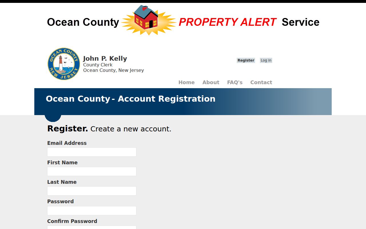
Use the block and lot copied from the parcel record so the alert is attached to the correct Little Egg Harbor parcel.
Little Egg Harbor Township Neighbor Privacy Limits
Public sources have firm limits. A household member can be absent from ownership records. Utility customers, delivery addresses, private membership rosters, and motor-vehicle addresses are not a substitute for the parcel trail. New Jersey’s Address Confidentiality Program provides eligible participants with a substitute address, and Daniel’s Law requires covered home addresses to be redacted from government web records. N.J.S.A. 19:31-3.2 also allows qualifying voters to register without disclosing a street address.
When a parcel, deed, voter, or map entry appears inaccurate, contact the original custodian with the record number and a precise correction request. Ask the assessor about parcel or tax data, the County Clerk about recorded documents, and the Board of Elections about voter status. A no-hit can reflect a protected address, incomplete identifier, or record limit. It does not establish that a person is absent from the neighborhood.